Incident Code
Incident Date
Location
Geolocation
Geolocation
Airwars Assessment
(Previous Incident Code: S085 )
A civilian car was reported hit in a coalition airstrike 20km to the south of Suluk, killing those inside. The attack was described as occurring near Umm al Brameel, to the south east of Tal Abyad. Among the dead was a child named as Mohmmad Ali Ahmad Al Assaf.
Geolocation Notes
Reports of the incident mention a civilian car being hit by an alleged Coalition strike 20 km South of Suluk (سلوك). The coordinates for the town of Suluk (سلوك) are: 36.59539, 39.128559. Airwars has identified two possible strike locations: 20 km along the SW road from Suluk (36.4344487, 39.107806) and 20 km along the SE road from Suluk (36.4364581, 39.2415118)
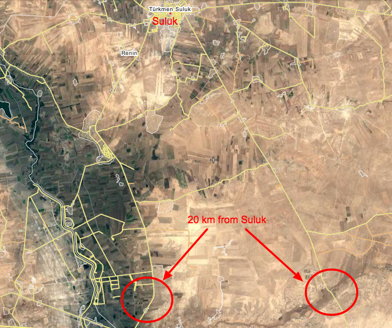
Two possible locations for the strike, 20 km South of Suluk (سلوك)
Imagery: © 2018 Wikimapia