Incident Code
Incident Date
Location
Geolocation
Geolocation
Airwars Assessment
(Previous Incident Code: S1237 )
More than one civilian was killed by suspected US-led Coalition airstrikes on Al Bedou neighbourhood, Raqqa.
Mohamad.othman.7503 posted photographs on Facebook of extensive material destruction on the “health, housing – Hawara School District”, whilst other sources published graphic photographs of civilians who were reported killed.
Raqqa is Being Slaughtered later reported on 4th September “The death of Khalil Mustafa al-Jasim al-Ba’zij as a result of the bombing by coalition airforce al Badou neighbourhood last Saturday.”
Geolocation Notes
Reports of the incident mention the neighbourhood of Al Bedou (حارة البدو) in the city of Raqqa (الرقة). The images above show destroyed residential buildings in the neighbourhoods of Al Bedou (حارة البدو) and Al Huni, which appear to still be intact on satellite imagery of August 13. The coordinates for destroyed buildings seen on satellite imagery in the neighbourhood of Al Huni are: 35.952789, 39.002935 and 35.952589, 39.003187. This incident might also correspond to the destroyed buildings seen on satellite imagery in Al Bedou (حارة البدو) (“health housing – Hawari school district”), for which the coordinates are: 35.963119, 39.003409
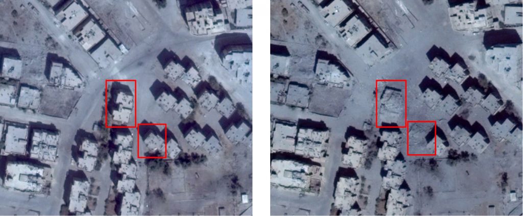
Structural damage seen in the neighbourhood of Al Huni, at 35.952789, 39.002935 and 35.952589, 39.003187 (left: 13 August, 2017; right: 25 August, 2017)
Imagery: © 2018 Google
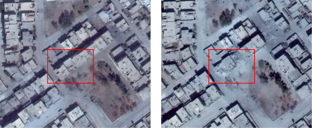
Structural damage seen in the neighbourhood of Al Bedou (حارة البدو), at: 35.963119,39.003409 (left: 13 August, 2017; right: 25 August, 2017)
Imagery: © 2018 Google