Incident Code
Incident Date
Location
Geolocation
Geolocation
Airwars Assessment
(Previous Incident Code: S1483 )
Three civilians, a father and his two daughters, died and many more were wounded in shelling of a camp for displaced people in the Abu Kamal countryside. It was not clear who was responsible for the incident as no sources apportioned blame.
According to the Syrian Observatory for Human Rights, unidentified warplanes carried out a massacre in the area of South Al-Refaei camp in the desert of Al-Bukamal. It said that a man and his two daughters died and that many more civilians were wounded – many seriously.
Sharqiya Voice named a man killed with his daughters by aircraft and artillery shelling of the camp, but didn’t say who was responsible.
The Coalition publicly reported no airstrikes in Syria that day.
Victims
Family members (3)
Geolocation Notes
Reports of the incident mention Suh Al Rifai (سوح الرفاعي), an Internally Displaced People (IDP) camp, and the countryside of Abu Kamal, near the village of Mu’ayzilah (معيزيلة), for which the coordinates are: 34.619365, 40.456123. Satellite imagery available to Airwars from December 2017 shows tents of IDP around the following coordinates: 34.483620, 40.531890
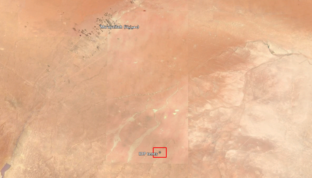
Location of IDP tents seen on satellite imagery of December 2017, near the village of Mu'ayzilah (معيزيلة)
Imagery: © 2018 Google