Incident Code
Incident Date
Location
Geolocation
Geolocation
Airwars Assessment
(Previous Incident Code: S1486 )
One child died in a Coalition airstrike according to local media.
The Syrian Network for Human Rights reported “a child died on December 3rd, due to wounds sustained from International Coalition warplanes which fired missiles on Darnaj village in Deir Ez-Zour governorate eastern suburbs on December 1, 2017″.
In June 2019 the Coalition accepted responsibility for this event noting” Coalition aircraft conducted an airstrike against Daesh terrorists. Regrettably, one civilian was unintentionally killed due to their proximity to the strike.” The Coalition additionally provided Airwars with the location of this incident, accurate to within a 100 metre box. Eleven months later this was declared to have been a US action.
The Syrian Observatory for Human Rights made no mention of civilian casualties but confirmed that the SDF had gained control of Daranj.
However, two other sources (Marsad Al Sharqiya and Obaidahalabdull) reported that the victim died in the town of Granij.
Other sources reported that the SDF had taken control of Daranj.
In May 2020, in its annual civilian harm report to Congress, the Pentagon declared this to have been a US military action.
Geolocation Notes
Reports of the incident mention two possible locations: the village of Darnaj (درنج), for which the coordinates are: 34.9244444,40.5791667; and the village of Garnij/Kharanij (غرانيج), for which the coordinates are: 34.7588889,40.7611111 Prior to the release of the MGRS for this incident, Airwars geolocated this incident to the nearest village at 34.9245045, 40.5793762. In June 2019 the Coalition released the MGRS for this incident: 37SFU445651.
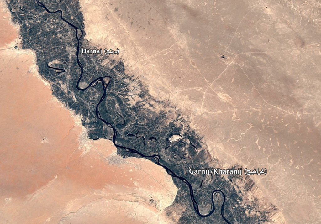
A geographic image of the villages of Darnaj (درنج) and Garnij/Kharanij (غرانيج)
Imagery: © 2018 Google