Incident Code
Incident Date
Location
Geolocation
Geolocation
Airwars Assessment
Up to three people were reported killed – one of whom was said to be a militant leader in the Ahrar al-Sham Movement which is affiliated with the Syrian National Army – in an alleged Coalition drone strike on their car on Afrin- Azaz road in Aleppo, Syria, on December 7th, 2019, according to local sources. The combat status of two of the victims was unclear.
The identity of those killed is not clear yet. While Aramme reported those killed were civilians, Step Agency said that they included a smuggler who transported people between Turkey and Idlib, and that he was accompanied by two ISIS leaders, one of whom was wearing an explosive belt.
A report by Jesr Press said that the strike targeted “a leader of the Ahrar al-Sham Movement in the northern countryside of Aleppo, which led to the death of him and two others who were travelling in the same car.”
However, the Smart News Agency reported that “the commander-in-chief of Ahrar al-Sham, Jabir Ali Pasha, and spokesman for the National Liberation Front, Captain Naji Mustafa, denied through their official knowledge that the dead were linked to Ahrar al-Sham, noting that the military tasks carried by the dead were forged.” But a ‘National Army’ ID card was found in the targeted car and referred to ‘Abu Sa’ad Al Hoss’ as the leader who was killed.
Other sources such as the Syrian Observatory for Human Rights (SOHR) reported the three allegedly belonged to Hayat Tahrir al-Sham (HTS).
In the third of their September 2020 civilian casualty reports, the US-led Coalition assessed reports that they were responsible for civilian harm in this strike as “non-credible”, stating that no Coalition actions were conducted in the geographical area at that time.
Geolocation Notes
Reports of the incident mention a vehicle being struck in the vicinity of the Qibar (قيبار) junction, while travelling between Afrin (عفرين) and A’zaz (أعزاز). Using visual information from available sources, we have narrowed down the location of the wreckage to a field northwest of Qibar. The coordinates for the wreckage are: 36.537842, 36.902342
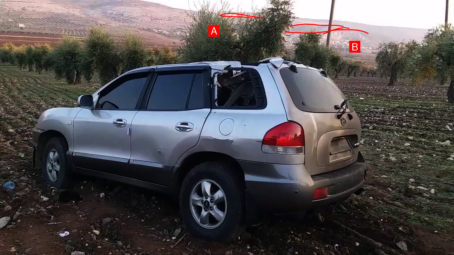
Matching features between footage of incident and Google Earth visualisations
Imagery: Nedaa

Matching features between footage of incident and Google Earth visualisations
Imagery: Google Earth