Incident Code
Incident Date
Location
Geolocation
Geolocation
Airwars Assessment
(Previous Incident Code: S1187 )
Summarising a 48 hour period, local sources said that 47 civilians were killed and 50 injured in alleged airstrikes on the city of Raqqa. Two of the eight sources specifically blamed the US-led Coalition for the civilian casualty incidents.
Activists told Smart News that “the city had been hit by more than 43 airstrikes, in addition to dozens of artillery and rocket-propelled grenades, in the past 48 hours, leading to the deaths and injuries. Most of the injuries were critical… Forty-seven civilians were killed and dozens injured, including women and children”. The severity of those injured was especially important to note in light of accounts of “deterioration of medical services”, the alleged “targeting of health centres”, and most recently the alleged “bombing of the national hospital”.
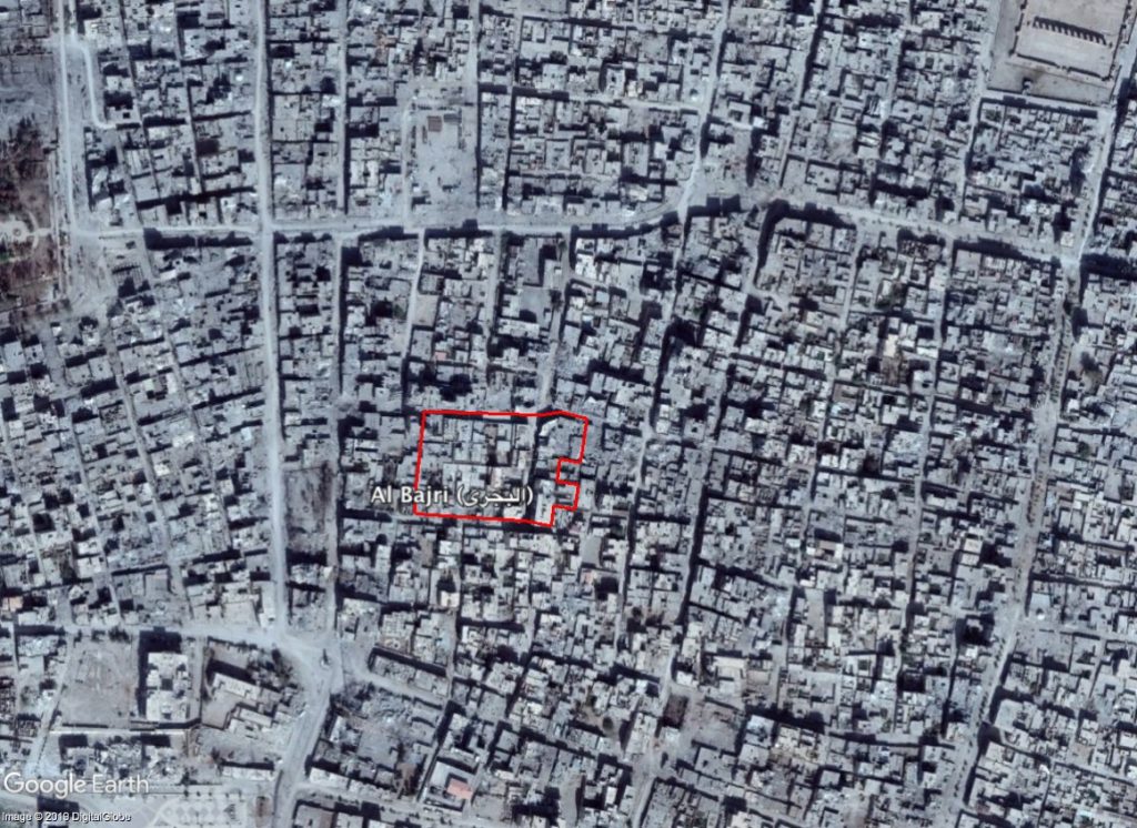
Al Raqqa Truth published a number of images reportedly showing “the massive destruction caused by aerial bombardment of Coalition aircraft and artillery shelling and by Kurdish units in different areas of the city of Raqqa”.
The same images were published by Raqqa is Being Slaughtered Silently which said that they depicted destruction in the Al-Bajri neighbourhood. The source also alleged that the Coalition was responsible.
These are general civilian casualty numbers, and there is a possibility that this entry could include other civilian casualty events.
Geolocation Notes
Reports of the incident mention the city of Raqqa (الرقة), for which the generic coordinates are: 35.9505639, 39.0094148. RBSS posted pictures of destruction in the neighbourhood of Al Bajri (البجري), for which the coordinates are: 35.948086, 39.015225.
Imagery: © 2019 Google