Incident Code
Incident Date
Location
Geolocation
Geolocation
Airwars Assessment
(Previous Incident Code: I036)
Local residents reported that seven civilians died in a coalition airstrike on Fallujah, with 22 more injured. There were claims that a number of neighbourhoods were hit, including in the west and south of the city. A resident of Fallujah of unknown status, named as Shawki Al-Abdal Saidi, put out a press statement claiming that the coalition, “launched a number of air attacks on the city, on Wednesday, killing seven civilians and wounding 22 others, including women and children.”
Al-Sharqiya reported that both coalition and Iraqi military aircraft participated in the assault, with additional artillery bombardment.
Key Information
Geolocation Notes
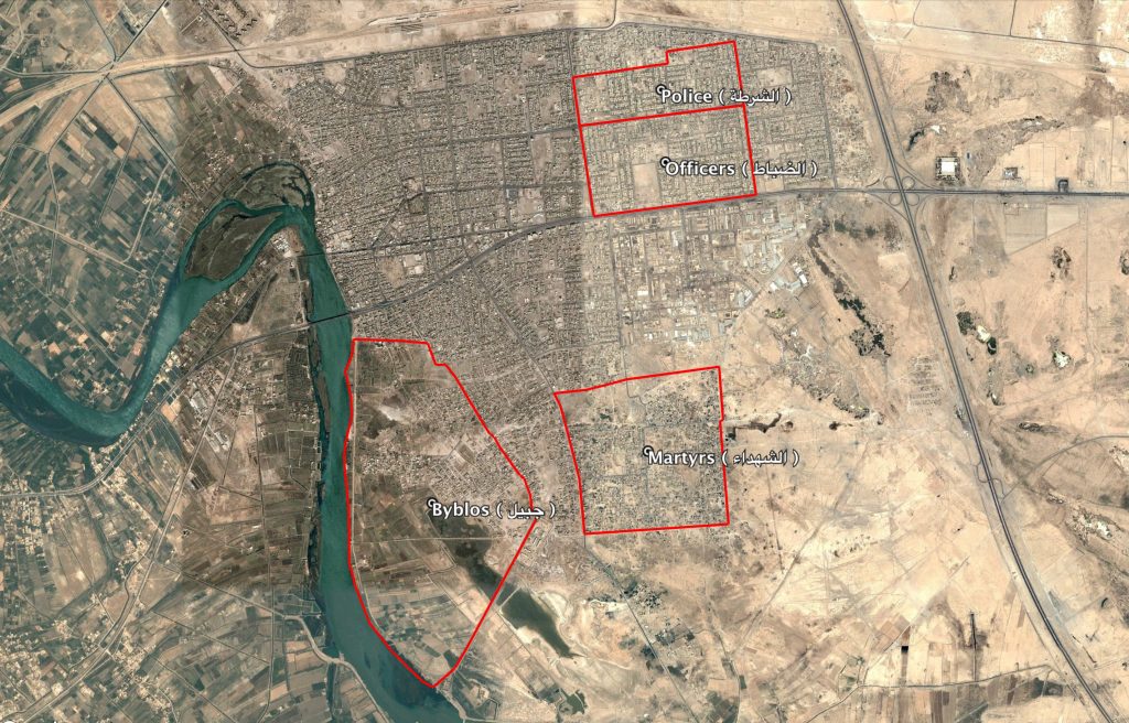
Reports of the incident mention multiple neighbourhoods within the city of Fallujah (الفلوجة), Anbar province: Golan Quarters (الجولان), Martyrs (الشهداء), Police (الشرطة), Officers (الضباط) and Byblos (جبيل). The Police (الشرطة) and Officers (الضباط) neighbourhoods are adjacent in the North East of the city; Golan Quarters (الجولان) is in the North West; Byblos (جبيل) and Martyrs (الشهداء) are in the South. Reports also mention heavy bombardment and up to 5 sorties, which possibly explains the naming of multiple neighbourhoods. The coordinates for the midpoint of Fallujah (الفلوجة) are: 33.3532137, 43.7875674

The neighbourhoods Golan Quarters (الجولان), Martyrs (الشهداء), Police (الشرطة), Officers (الضباط) and Byblos (جبيل) in the city of Fallujah (الفلوجة)
Imagery: © 2018 Google
