Incident Code
Incident Date
Location
Geolocation
Geolocation
Airwars Assessment
(Previous Incident Code: S068)
According to Al Jazeera and others, a Coalition strike on the al Nusra Front at al Tawama destroyed a number of civilian buildings, killing as many as seven inhabitants. Fifteen alleged militants – most described as ‘Turks’ – also died in the attack which reportedly struck two separate locations in the village. According to Sana Revolution, an additional four civilians also died at the second location.
However SN4HR reported only one civilian fatality, that of a 9-year old girl who was the niece of al-Nusra commander Bader al Dakas who later described her death: “My niece and my sister were staying with me in the house. Most of the time we’re not in the house, we’re on the battlefield so this is considered a civilian house. She was hit by shrapnel and was killed yesterday around six in the evening. She was on the roof when it happened and she was martyred. She was 9 years old.”
According to al Watan “Witnesses from the village reported that a plane believed to be an F-16, flew over head for more than a quarter of an hour, before carrying out two consecutive raids on Al-Nusra Front’s base.”
On May 22, 2015, only two days after the alleged incident, a Coalition spokesperson confirmed to Airwars that it had “conducted airstrikes against terrorist compounds near the village of Al Tawama, Syria, May 20.” However, they declined to say whether any specific investigation into alleged civilian casualties was underway. On May 24, 2016 the Coalition again confirmed the Tawama strike in a public statement and added, “there were no observed women, children or non-combatants in the compounds at the time“. To date, Airwars has seen no record of an investigation either by the Coalition or CENTCOM. We remain unclear as to why.
Key Information
Geolocation Notes
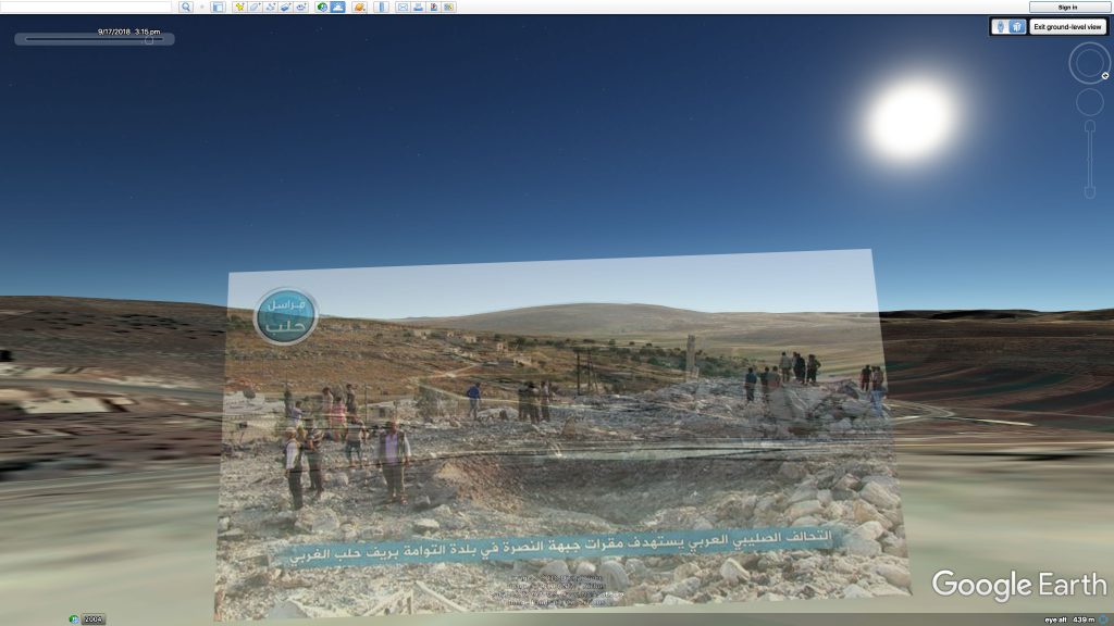
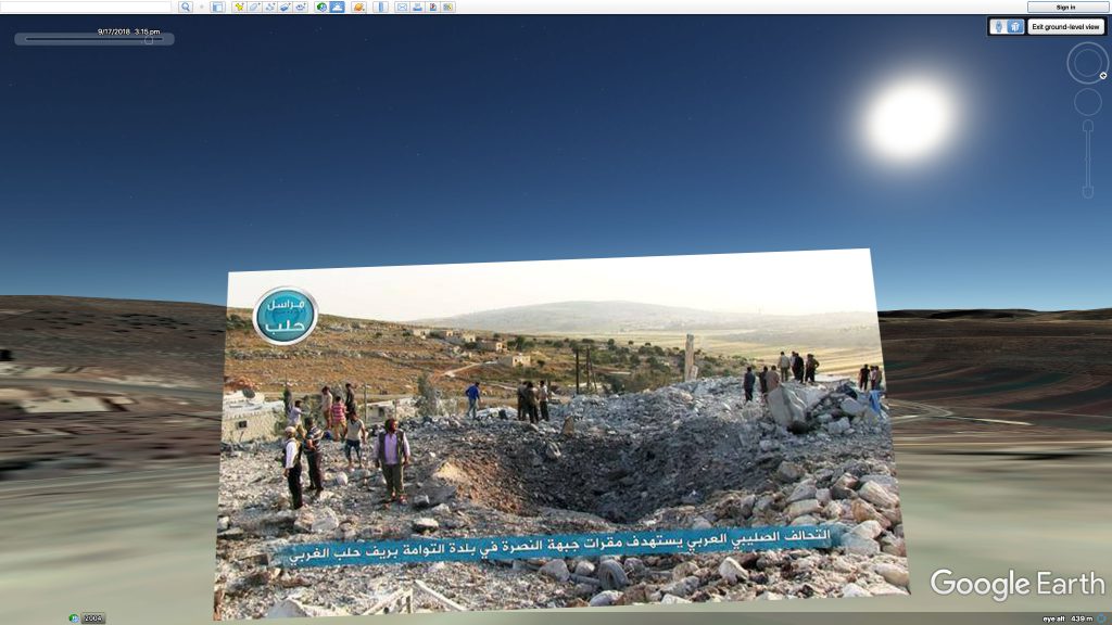
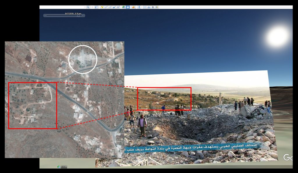
Reports of the incident mention the village of Tawama (التوامة), of which the coordinates of its midpoint are: 36.19327, 36.80928. Satellite imagery from April 2016, taken 10 months after the incident, shows visible structural damage in the area, in comparison to satellite imagery taken prior to the incident. In addition, using Google Earth Terrain ground view, Airwars was able to geolocate images provided by media, further verifying the location of the incident.

The village of Tawama (التوامة), showing visible structural damage (left: 26 August, 2014; right: 29 April, 2016)
Imagery: © 2018 Google

East of the village of Tawama (التوامة), showing visible structural damage (left: 26 August, 2014; right: 29 April, 2016)
Imagery: © 2018 Google

West of the village of Tawama (التوامة), showing visible structural damage (left: 26 August, 2014; right: 29 April, 2016)
Imagery: © 2018 Google

Google Earth ground view matches the image (camera facing South West, late afternoon to early evening)
Imagery: © 2018 Google

Google Earth ground view matches the image (camera facing South West, late afternoon to early evening)
Imagery: © 2018 Google

Geolocation based on the matching Google Earth ground view
Imagery: © 2018 Google

