Incident Code
Incident Date
Location
Geolocation
Geolocation
Airwars Assessment
(Previous Incident Code: S1201 )
Between six and ten people were reported killed including 2 or more children, in an “aerial bombardment” on the city of Raqqa. At present nearly all of the sources allege that the US-led Coalition was responsible for the incident.
Significant material destruction was caused to the Baladi Stadium area and the School District of Muawiya in the city of Raqqa, local sources said.
The Syrian Network for Human Rights said that the bombardment by “International Coalition warplanes” had left “several people injured” and that because of this the death toll may increase.
The citizen journalist group, Raqqa is Being Slaughtered Silently, identified two of the civilians killed.
In their monthly civilian casualty reports, the US-led Coalition has indicated that the credibility of this civilian harm allegation is in the process of being assessed.
Geolocation Notes
Reports of the incident mention the School District of Muawiya (for which the coordinates are: 35.961024, 39.002031) and the Baladi Stadium (35.956943, 39.005857). Based on images published by media (as seen above) Airwars was able to establish the coordinates for the damaged building in the first image (35.955831, 39.004828) and the building on fire (35.956667, 39.007594). Damage to the first building can be seen on satellite imagery between August 13 and August 19, 2017.
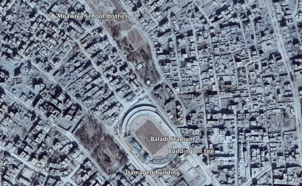
Geolocated media by Airwars near the Baladi Stadium and Muawiya School district
Imagery: © 2018 Google
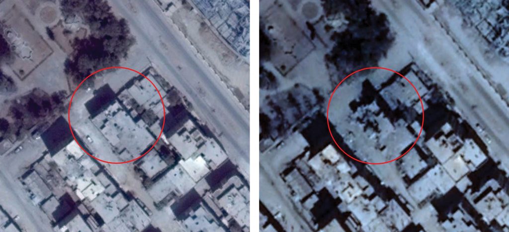
Damage to building seen on satellite imagery (left: August 13, 2017; right: August 19, 2017)
Imagery: © 2018 Google