Incident Code
Incident Date
Location
Geolocation
Geolocation
Airwars Assessment
(Previous Incident Code: S1275 )
Local media reported that “a leader of the Islamic State, and his son were killed in a raid by the Washington-led international coalition aircraft” al Laayadh area, near the river crossing, بقرص تحتاني Bokros Tahtani, Eastern Deir Ezzor.
According to Euphrates Post among other sources, he was “coming from the town of Al-Shuhail on a boat and was liquidated immediately upon arrival in Bokros”.
It is unclear from the sources if the son was also a member of the so-called Islamic State organization. All of the reports obtained said the US-led Coalition was responsible.
Geolocation Notes
Reports of the incident mention a river crossing near the village of Bokros Tahtani (بقرص تحتاني). The coordinates for the village are: 35.054100, 40.450115, and the coordinates for a nearby river crossing seen on satellite imagery are: 35.068116, 40.456966. The river crossing was established in late 2016 and was still active in September, 2017
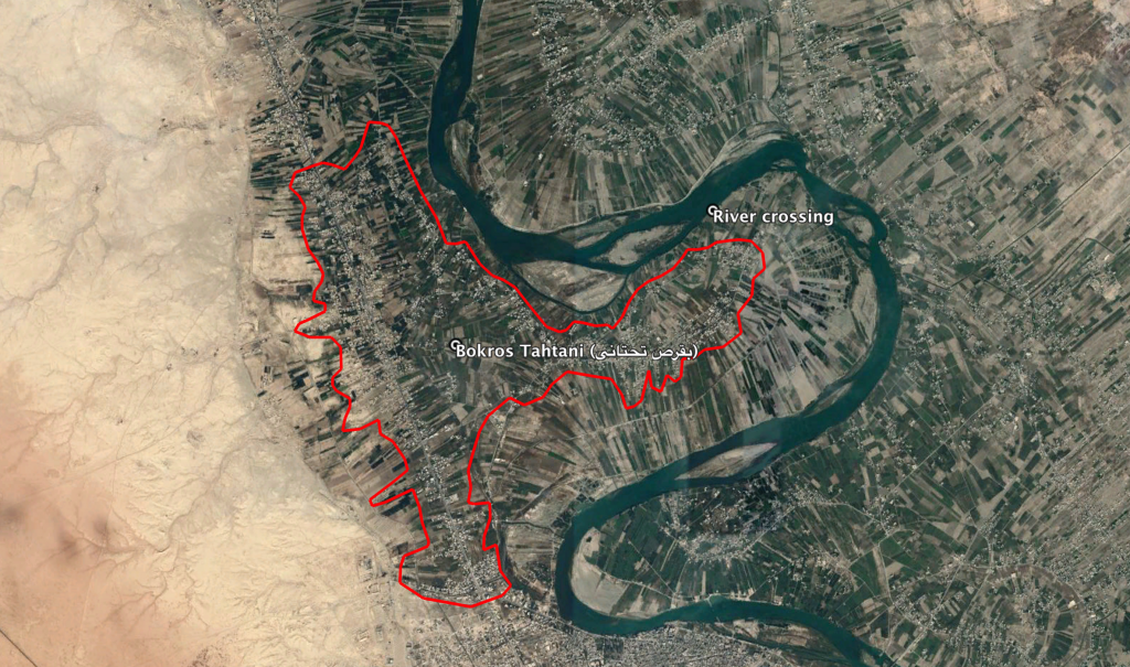
The village of Bokros Tahtani (بقرص تحتاني) and the nearby river crossing, active in September 2017
Imagery: © 2018 Google
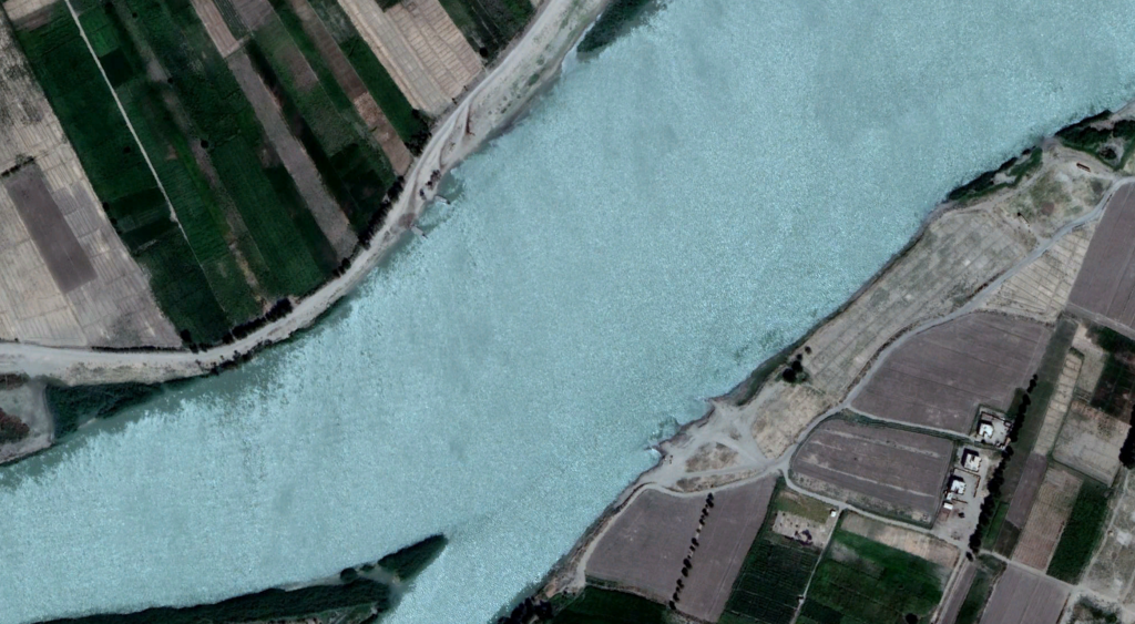
River crossing near Bokros Tahtani (بقرص تحتاني) seen on satellite imagery of September 7, 2017
Imagery: © 2018 Google